Welcome to the Midnight Collective Broadsheet 77
Actively
supporting NZ’s endangered wetland birds
 |
| Life returns to the Wharemauku - young black shag in the lower reaches |
We have been out taking the measure in the
aftermath of our recent storm and it seems we have had been fortunate; at least here in Raumati Beach. Houses
were abandoned but water has entered few even while making a dog’s breakfast of
the gardens.
 |
| Flooded dwelling flood level visible on fence |
Then there’s slippage along the banks.
 |
| Typical stopbank slippage along Wharemauku |
Meanwhile a large boulder from further up the Wharemauku
has been shipped 2 kilometres out towards the sea. It’s always a surprise to see how water can move such
seemingly immovable objects when it gets as high as this.
 |
| Large boulder stranded after flood - lower reaches |
It’s left a mess of course, but a front
end loader has cleared the track while the fire brigade have been busy pumping
out water from low lying sections. There’s nothing like a crisis to bring a
community together, so long as it doesn't last too long.
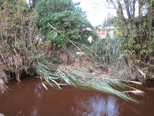 |
| Undermined toetoe in lower reaches |
Meanwhile it’s interesting what can be learnt
from an emergency like this. The flood stopbanks on the Wharemauku are the
result, not of precisely engineered expertise but the more halting process of learning
from experience. As each flood has breached or topped a section of the bank, at
least from the 1920’s when this area was first surveyed, remedial work has then raised or extended it. This may indicate that these floods are getting more destructive,
(the result of deforestation), but also that each flood has its own unique character.
Another issue is centred on the Met
Service and how we measure rainfall. A reasonably large but not troublesome storm
will drop around 70 mls, though the damage a flood can do is dependent as much
on the speed with which the rain falls, as on the volume of water. Then it's significantly worse if coincident
with a high tide. Interpreting longer term weather trends is notoriously
difficult which is why anti-global warming nutters still get so much air time,
but there’s a growing consensus along this western coast, that we are getting
more of these extreme weather events, (which are glammed up in the media as weather
bombs.)
Another issue centres on the reliability
of the Met readings posted in the media. There is a pretty vocal response in
summer (and isn’t this true of every community across the planet!), when people
think the reported Met temperature for the day is too low. Everyone has an opinion and someone
is always rising up onto their hackles because they disagree with the TV. It’s
taken as a personal affront on behalf of the community.
The Met's weather girls (they all used to
be male), take their reading from one site quite close to here, at the airport.
Yet how accurate a picture of a rain storm can you get from a reading on just
one site. The important readings for a flood like this should be from up in the
Tararua foothills, so this might potentially mislead about the likelihood and
progress of a major flood.
 |
| Still munted after all these weeks -NIWA polution monitor on the Wharemauku |
Here we have a case in point because when
we posted our first flood review (around 2 in the afternoon), the Met readings
were around 90mls, which had climbed to 115 by morning. Ross Waterhouse however keeps
an eye on his own gauge over in Waikanae which is 8 km due north as the tui
flies (We don’t have crows out here). His reading over the same period came in
at 152mls.
 |
| Generations have trod |
 |
| have trod |
 |
| Have trod |
Meanwhile as you can see from the above fotos the dune lake is almost a wetland of the past.
Track we were listening to while posting
this is Nina Simone.
He’s Got The Whole World In His Hands – because you asked for this bitter sweet rendition of a wonderful black American
gospel rave…
He's got the fish of the sea in His hands
He's got the birds of the air in His hands
No comments:
Post a Comment