Monday 26 September 2016

M2PP Expressway -The Big Flood –Is Kapiti flood management at risk? Part 1 the Setup.


Welcome to the Midnight Collective Broadsheet 122
Actively supporting NZ’s endangered wetland birds
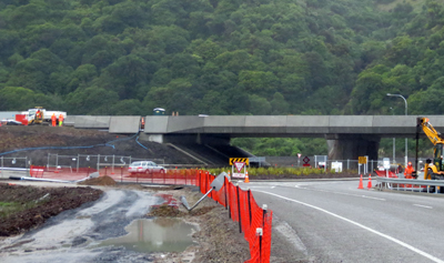
Wharemauku creek Bridge - from the West looking East
Last weekend (17-18 Sept) we had another large flood. This  followed the major storm event of last May when houses were evacuated around the lower reaches of the Wharemauku. This overnight storm dumped 150mm onto this coastal plain and then just kept going. The latest storm brought a lesser amount. around 125mm over a longer period -60 hours so the Wharemauku didn’t top its banks this time, but it stayed at banktopping level over this time while the flooding around the expressway was immediate and spectacular.

There has been no coverage of this in the local press so we are going to go through from the beginning. This will take a couple of posts so bear with us.

Aerial shot of dune lake before destruction
This is an orientation picture of the swamp as it used to be (2012). The Wharemauku creek weaves from lower right (east) through the settlement, then out top left (west). The Expressway has bisected this dune lake, cutting along the bent white line at top right of this Council foto. The original dunelake (dark spot in the middle of the orange) had been used as a holding pond, but has now been drained; while contractors are currently digging out and landscaping an  area on the Eastern side of the expressway.

Eastern excavations in progress
This area was being pumped out the day before the storm, over to the western side of the expressway and was pretty much empty.
Pumping water to west
The leaking hose
We reported previously that this area had been drained out into Drain 7, below the pollution monitors. Following our report this drain has been closed off. We are not sure whether we should take credit for this, but the effect was immediate in showing in clearer (though still dirty) water in the lower Wharemauku. This western side of the expressway however, now began to fill with dirty water being pumped from the east.
Western side before storm and draining - with new plantings under water


Dirty water pumped through e/way to west.
A new drain has been opened to drain the dune lake, into the Wharemauku but this was blocked by a large steel plate.
steel plate blocking drain
As the Wharemauku began to flood however, the force of water pushed aside the plate and began to backfill the whole area. 
Wharemauku Saturday morning -17th sept plate askew and backfilling underway
A farmed area above the bridge and nearer town usually acts as a flood plain for the creek, releasing water to help protect the residential area below from major floods.  But the Wharemauku wasn't bursting its banks and this area remained clear as the creek began to rise through Friday night. But with the bridge drain set low in the creek by the Saturday morning, both sides of the Wharemauku area had been engulfed. Come lunchtime the NZTA had sent a lone worker with a shovel down to sort it all out. 
A finger in the dyke? Shovelling in the storm lunchtime Saturday - 
This looks rather like the NZTA hasn't really much of a clue about what was happening down here. So did they?
In the next post we track the rising water…meanwhile  the track we are listening to while posting this is Leadbelly –Aint gonna study war no more. 

Gonna lay down my sword and shield
Down by the riverside
Gonna lay down my sword and shield
Down by the riverside
Ain't gonna study war no more.

He put that out 50 years ago and has it made a difference? We’re thinking of all those caught in Aleppo at the moment so that question answers itself.


Wednesday 14 September 2016

M2PP Expressway management problems - A whistleblowers account...


Welcome to the Midnight Collective Broadsheet 121
Actively supporting NZ’s endangered wetland birds
Overpass Raumati South
One of the large issues surrounding this expressway project has been the media firewall around it. Most of the stories appearing in the local press have been written by the NZTA’s media team, and it was clear from the response of the WGRC to complaints of pollution (see last post), that even they didn’t have a clear understanding of the management structure they were trying to work with.
 

Issues have begun to surface around the management of this expressway construction as it nears completion however, and we are going to run through them.


We were surprised to have a frank discussion on site with one of the project managers. He made a number of points, the first concerning the contractor's relationship with the NZTA. He made it clear that the decision-making process lay solely with the contractors and that the NZTA, these are his exact words, ‘just pays the bills.’


This raises the issue of  how this National Government monitors and controls large privatised projects of this nature. They are steeped in secrecy. The controversy that led to the sacking of private contractors, SERCO from its contract to manage Mt Eden Prison for example, only came out into the open when video evidence of incompetence was posted on youtube. There appears to be no open public accountability on these projects which involve the expenditure of large amounts of taxpayer’s money.


He then raised concern in two more areas.  The project’s contractors were employing young, inexperienced engineers some of whom, he noted with exasperation, ‘had trouble getting to work each day’.  It seems reasonable to assume that this employment strategy is designed to keep salary costs to a minimum. But is it putting the construction decision-making at risk?


In a second point he expressed his concern regarding the design of the off and on ramp access from the Expressway into Kapiti Road. There was no way he said, that it was going to cope with the amount of traffic (including trucks) that would now be funneled into and out of the centre of Paraparaumu, once the expressway opens. He isn’t the only one to have raised this issue. Mayoral candidate Angela Buswell has also publicised her skepticism oon this issue while a number of recent local letters to the editor, have expressed the same concern. Here are some on site fotos to illustrate the problem.  
Kapiti Rd approaching E/way overbridge 
On ramp south - Will this handle 10,000 a day, including articulated trucks
Off ramp from south - Same question... 
Where we don’t have any information about the construction, the only thing left is to speculate, and here warning bells are raised over the case of the missing roundabout. The bridge at the southern end of the expressway was initially designed to have two roundabouts funneling traffic into Poplar Ave, and then south from it. This was in the design ok’d  by the Board of Inquiry. So where is the second roundabout? 
Now you see it (green circle right) 
Now you don't...
Who made the decision to  drop it from the design? On what basis was the decision made?  How will traffic flow be affected if this becomes a major point of departure for traffic attempting to avoid a jammed up Kapiti Road?

Then more seriously, if it has happened here has it happened elsewhere on the expressway?

A point of concern raised at the Board of Inquiry and not satisfactorily dealt with there, was how the Expressway contractors were going to manage this construction through a major swamp. The NZTA’s preferred solution was to dig it out and lay a firm (sand) base to the road. It was here at the southern end that this strategy was first implemented, and then abandoned. We kept a watch on this as the foundations were laid and the swamp appeared too deep and kept filling with water. 
Beginnings of Poplar Ave bridge excavation. February 2014
Bogged in - and this was in the middle of summer February 2014 


Same site today
Presumably it was here that this ideal was abandoned. Time and financial constraint must have come into their decision making.

The question raised is this. How much of this expressway has been laid upon a swampy base. What are the long term structural implications of this? At the Board of Inquiry it was stated that the new expressway would be left to settle for six months before it would be opened for traffic. Has this protocol been observed? The E/way is now six months ahead of schedule. Does this provide the reason? If so what are the long term implications of this decision-making?     

As a final note – the airing of these issues on this blog has generated quite a lot of local traffic so it appears we aren’t the only ones concerned and troubled by the issues we are raising.


Track we were playing while posting this – there’s lots of concern starting to build now about the long term welfare of our Democracy, especially as the corporate body politic,  tightens its grip around the world, around us. (It's past time Apple and all their co-offenders, as one example, started paying the same tax we do - though this is just one of issue among many).  So  today we are running with Oscar Brand and    Free and Fair Elections…  Susie is right behind this one.


Wednesday 7 September 2016

M2PP -Expressway pollution of Kapiti Waterway -The Full Story


Welcome to the Midnight Collective Broadsheet 120
Actively supporting NZ’s endangered wetland birds

Those who have been regular followers of this environmental story will be familiar with the watch we have been keeping on the levels of pollution entering our local waterway –the Wharemauku- through the destruction of a rare dune lake here at Raumati Beach.  This controversy has recently hit the headlines in a local paper.


The safety of our waterways is in the hands of the Greater Wellington Regional Council (GWRC)  and they have responded to the discolouration in the story above. Regional Council competence is coming under fire after an outbreak of severe enteritus over recent weeks infected 5000 in Havelock North and made international headlines. It has been provisionally traced through the town water supply to local dairy farming.

Our local pollution story was stimulated by a graphic image of the polluted Wharemauku taken by Jamie Guertjiens, but the pollution isn't new and here are some more images we have taken over the last two years.
Wharemauku
Wharemauku
And here is the Wharemauku before the M2PP excavation got underway.
White faced heron in lower  reaches of Wharemauku before M2PP 
Here is why we don’t  believe the WGRC.

We have been watching this stream for five years now, and these levels began to rise  sharply when expressway excavation started, while the red colouration began appearing when locally quarried rock was trucked to the site. 

Drain 7 - The drain opposite is running clear
The GWRC is correct in locating the pollution source as ‘natural’ but it is the level, density and constant flow of the pollution which are at issue. Discolouration occurs after rain but it previously cleared within two or three days. It still does this in drains that are not linked to the expressway. The GWRC as the guardian of our waterways, should know this. Nor does it take any initiative to follow the pollution back to its source in Drain 7.
Drain 7 
We laid a complaint with them last year over two issues – the pumping of polluted water from the NZTA excavations into the Wharemauku below pollution monitors. These were set up at the directive of the Board of Inquiry that issued consents for this work which could close the site down if pollution reached unacceptable levels. We also provided evidence that the pollution  monitors themselves had been out of commission for months on end.
In hiding   Dysfunctional Pollution monitor
We got a reply similar to the one supplied to the Kapiti News, until we showed them photographs of the NZTA pumps at work. The GWRC advised that the NZTA didn’t have a consent to discharge into the Wharemauku, so they then got off their laptops and undertook a more serious investigation. The result determined that under National Government regulation, the NZTA could do pretty much whatever it wanted. 

Why didn’t the GWRC know this? 

What the NZTA further advised however was that it had workers with hand monitors stationed on the banks of the stream while this pumping had been going on. We had never seen this, though what we had seen were pumps hard at work early Sunday morning with no-one around. But we had to take them at their word until this years autumn rains set in. The NZTA had denied all along that there was a dune lake down here and finding that there was one and that their excavations had enlarged it, they now opened a permanent drain into Drain 7. Here it is...
Polluted water from M2PP  draining into Drain 7 then to the Wharemauku below the pollution monitors
This empties into the Wharemauku  below the monitors and is the primary source of the pollution.

One indicator of its seriousness has been that local ducks are now avoiding these lower reaches. Marine life in this rich and delicately balanced waterway, must be similarly affected.
Drain 7 pollution into the Wharemauku
Turning the Wharemauku to Styx -Recent foto of polluted stream
Other waterways that appear to be impacted by the disturbance of this 1000 year old swamp are Andrews Pond and Ratanui Road though our readers will be interested to learn that Forest and Bird are keeping a close watch on these developments.
A  blackened Andrews Pond 
Next post – Trouble at Mill? – A whistleblower gives an account of problems inside the M2PP expressway consortium.

Track we were listening to while posting this – Slim Whitman A Fool Such as I 
Now and then there's a fool such as I am over you
You taught me how-ow to love and now-ow
Now you say we're through

Bob Dylan ran a version of this off through his peerlessly glass papered throat and nose, though nothing  can compare with this operatic tenor that came boating out of American country and then western  music through the fifties… Susie cant abide this so we're sneaking it in unbeknownst.